Before-and-After Images Show Ongoing Flood Disaster in Nebraska and Iowa
By Chris Dolce
16 hours ago
weather.com
01:09
Midwest Flooding Kills at Least 3, Forces Thousands to Evacuate
At least three people are dead, thousands were forced to evacuate and entire towns were cut off as several states across the Midwest were hit with historic flooding.
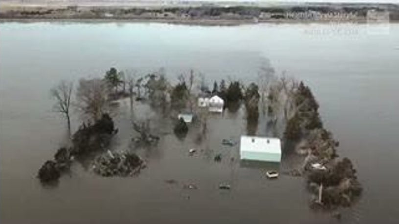
Disastrous flooding is gripping parts of the Plains and Midwest, inundating towns and damaging infrastructure. These before-and-after images give a view of what some of the hardest-hit locations in Nebraska and Iowa are dealing with.
(MORE: Latest Flooding News)
Below you can see how the Spencer Dam on the Niobrara River south of Spencer, Nebraska, was destroyed on Thursday.
(Before image: Nebraska's Natural Resources Districts | After image: Nebraska.gov)
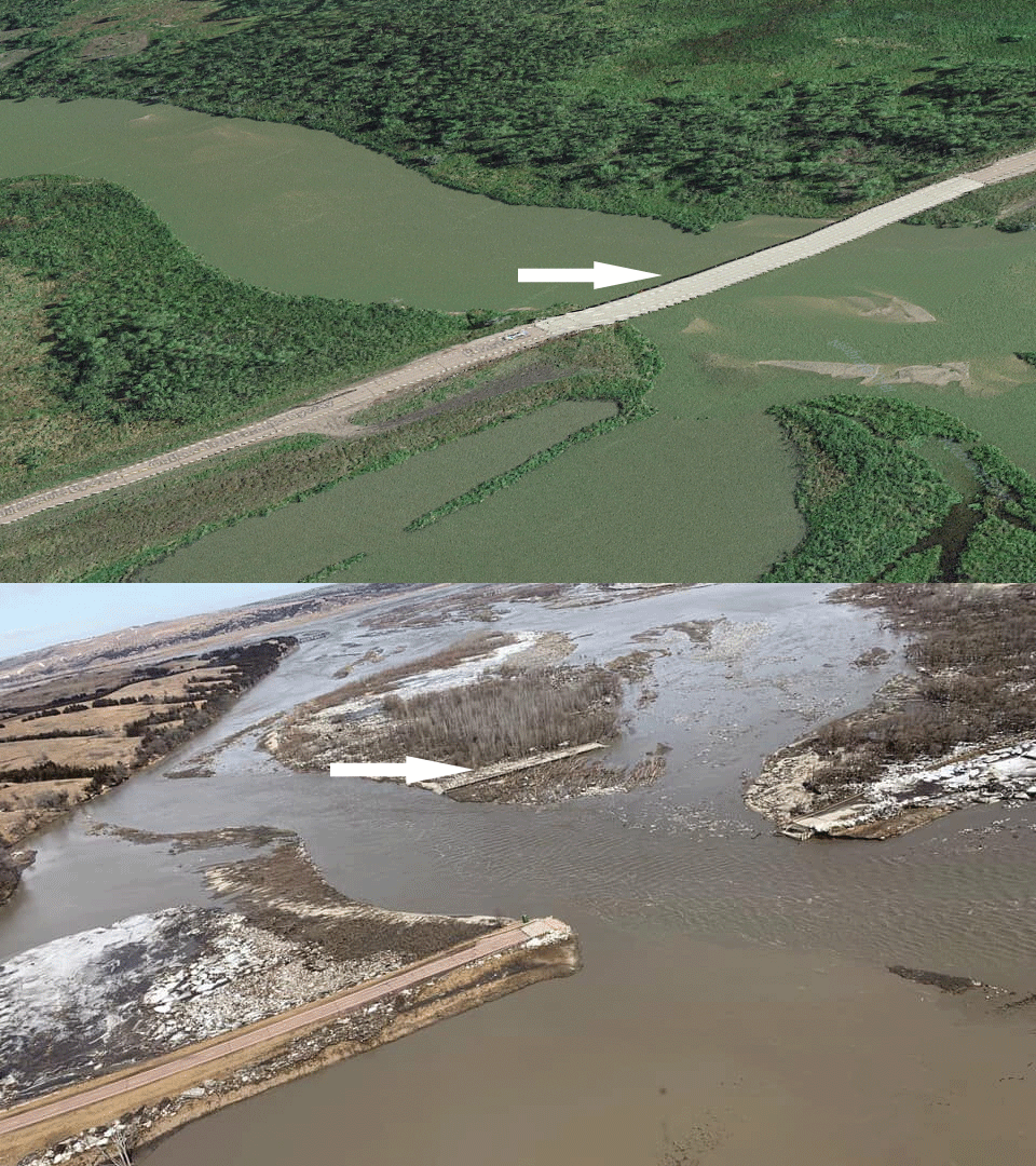
Floodwaters then surged down the Niobrara River toward the town of Niobrara, Nebraska.
In this photo you can see how a bridge was destroyed over Highway 12 west of the town. The white arrow shows how the bridge was swept a short distance downstream.
(Before image: Google Earth | After image: Nebraska.gov)
Next is another photo of Highway 12 which was also damaged just west of Niobrara, Nebraska.
(Before image: Google | After image: Ben Sasse/Twitter)
This aerial photo shows flooding from the Missouri River spilling into Offutt Air Force Base near Omaha, Nebraska.
(Before image: Google Earth | After image: 55th Wing Commander/Facebook)
Flooding in the town of Valley, Nebraska, located just west of Omaha, is seen in this next photo.
(Before image: Google Earth | After image: Ben Sasse/Twitter)
Here's another view of flooding in the town of Valley, Nebraska.
(Before image: Google Earth | After image: Nebraska.gov)
Severe flooding from the Missouri River has inundated parts of Fremont County, Iowa. These next two photos show the town of Bartlett which is along Interstate 29.
(Before image: Google Earth | After Image: Fremont County Iowa EMA/Facebook)
(Before image: Google Earth | After Image: Fremont County Iowa EMA/Facebook)
The Weather Company’s primary journalistic mission is to report on breaking weather news, the environment and the importance of science to our lives. This story does not necessarily represent the position of our parent company, IBM.
- Forums
- General
- Townsville not the only Place in World for record floods
Townsville not the only Place in World for record floods, page-2
Featured News
Featured News
The Watchlist
ACW
ACTINOGEN MEDICAL LIMITED
Andy Udell, CCO
Andy Udell
CCO
SPONSORED BY The Market Online


