Hi Guys
WAL EPC 1067
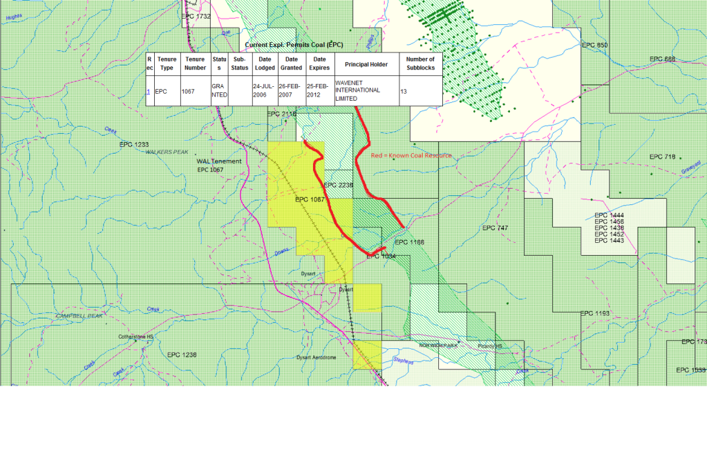
I thought i would share a location map of WAL's tenement EPC 1067 and its neighbour BHP. The map below shows WAL's currently granted exploration permit for coal (EPC 1067). Also shown in the map below is the known resource for coal in the current area. Theses are indicated and infered as per a correlation of data by the queensland government. As you can see WALS permit EPC 1067 is partially exposed to the indicated area (shown by the red outline)
WAL EPC 1067, BHP Saraji and Saraji EPC
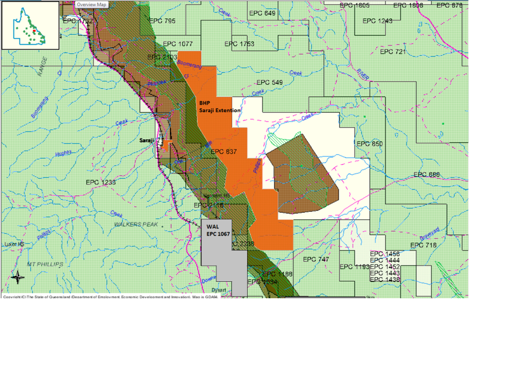
The image below shows an expanded view of the same area, with BHP's tenements and operations highlighted in orange. The smaller tenement in orange is the Saraji coal mine which is currently producing 8mt per annum of hard coking coal. The larger area highlighted is BHP's Saraji extention lease, which is currently being explored. This map also gives a good indication of how close WAL's EPC is to BHPs tenements and also the open pit operations in the area. These areas are shown by the darker green shading and brown shading on the map (Excluding the light green colour that is abundant).
Hope these images are useful to other investors and holders. GL to all holders
GB
- Forums
- ASX - By Stock
- WAL
- wal tenement locality to bhp
wal tenement locality to bhp
-
- There are more pages in this discussion • 13 more messages in this thread...
You’re viewing a single post only. To view the entire thread just sign in or Join Now (FREE)


